|
Nepal Travellers Blogs
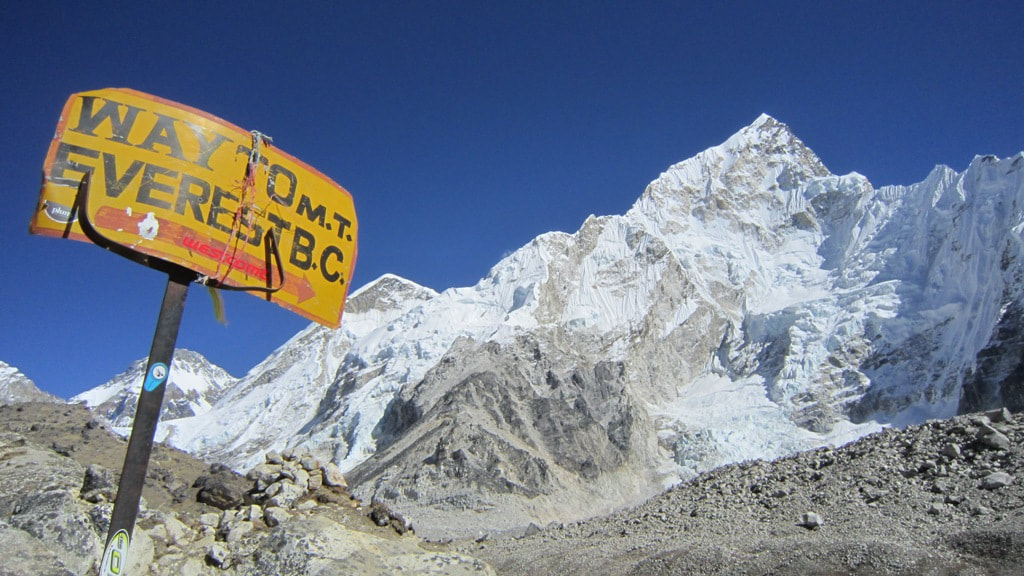
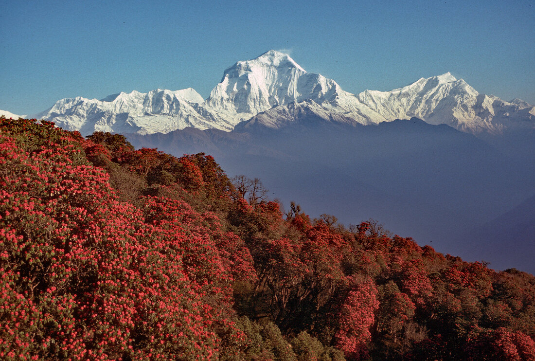
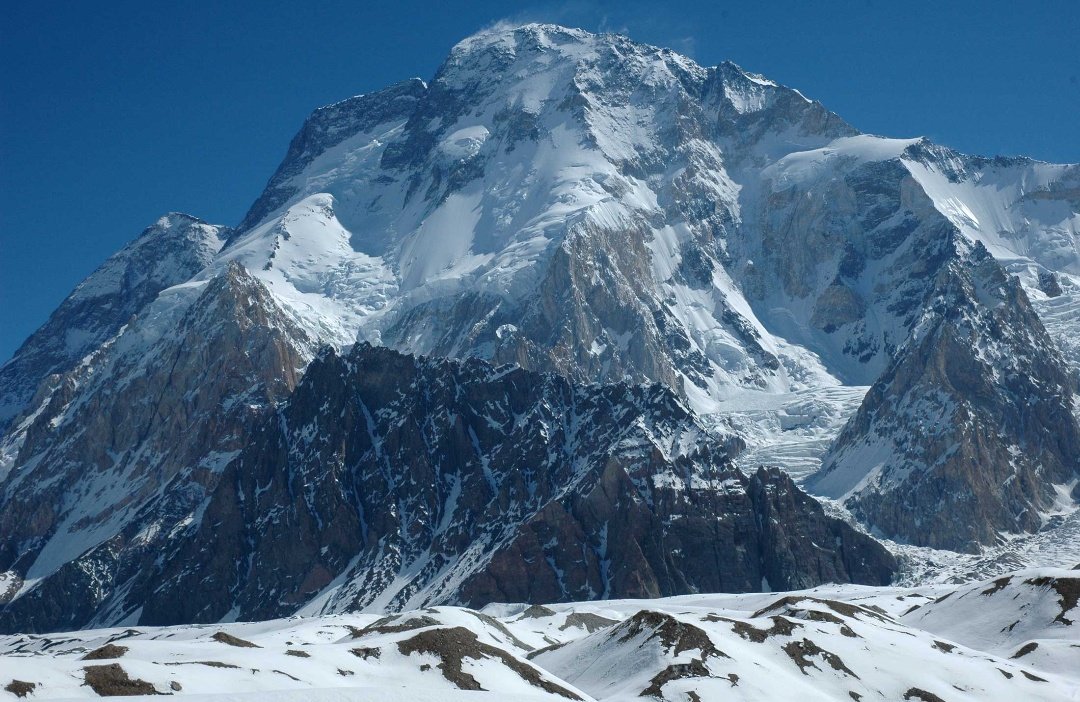
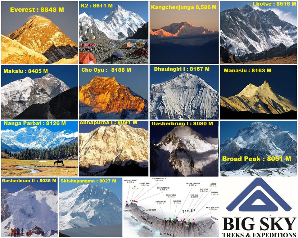 8000 meters mountain in world 8000 meters mountain in world The International Mountaineering and Climbing Federation or UIAA recognise eight-thousanders as the 14 mountains that are more than 8,000 metres (26,247 ft) in height above sea level, and are considered to be sufficiently independent from neighboring peaks. However, there is no precise definition of the criteria used to assess independence, and since 2012 the UIAA has been involved in a process to consider whether the list should be expanded to 20 mountains. All eight-thousanders are located in the Himalayan and Karakoram mountain ranges in Asia, and their summits are in the death zone. Mt.Everest : 8848m The highest mountain in the world Mount Everest :8848 Meters First highest mountain in the world Location :Nepal Latitude: 27° 59’ 17” N, Longitude: 86° 55’ 31” E First Ascent : 1953 May 29 First climber : Tenzin norgay sherpa & Edmund Hillary Ever since the highest peak in the world was identified by an employee of the Geological Survey of India in 1852, the mountain has fascinated and drawn climbers from around the world. Known simply as Peak XV when the historic discovery was made, it was eventually named ‘Everest’ by the then Surveyor General, Andrew Waugh in honour of his predecessor, George Everest. The Tibetans and Sherpas (who lived close to the mountain) knew it as Chhomolungma and the Nepalese Government later gave it the name ‘Sagarmatha’. The early climbers like the famous duo, George Mallory and Andrew Irvine attempted to climb from the Tibetan side which lies on the northern side of Everest. K2 : 8611m The Second highest mountain in the world K2: 8611 Meters Second highest mountain in world Location: Pakistan, Latitude: 35° 52' 54'' N, Longitude: 76° 30' 46'' E First Ascent : 1954 July 31 First Climber Achille Compagnoni ,Lino Lacedelli K2, the world's second highest mountain, richly deserves the place it has earned in the public's imagination as an equal to Everest in the mountain pantheon. The question of what is the hardest mountain in the world to climb will never be objectively determined, but K2 offers as compelling a case as any peak for the honor: extreme altitude, massive scale, steep slopes on all sides, unstable weather, killer avalanches, remoteness from roadheads, and a location in a politically unstable region near a war zone. K2 lords over the Karakoram Range on the border of Pakistan and China, and is not located in the Himalaya (although calling the Karakoram part of a vague "Greater Himalaya" region would not be totally inaccurate). It is a massive pyramid, without the major sub-peaks, shoulders, or buttressing ridges common on the Himalayan peaks like Everest. To climb K2, you must really climb it, from the base, and there are no shortcuts. Kanchenjunga : 8586m The third highest mountain in the world Kanchenjungha: 8586 Meters Third highest mountain in world Location :Nepal, Latitude: 27° 42’ 09” N, Longitude: 88° 09’ 25” E First Ascent : 1955 May 25 First climber : George Band & Joe Brown There was a time when Mt. Kanchenjunga was considered the highest mountain in the world. This was before the startling discovery made by the Chief Computer (today they are replaced by machines) who pointed out that Peak XV was in fact higher than Peak IX, Kanchenjunga. Later it became apparent that Peak IX was actually only the third highest mountain after Everest and K2 (Karakoram, Pakistan). It lies 128 km east of Everest. The western face lies in Nepal while the other side lies in the state of Sikkim, India. Kanchenjunga or Kangchenzonga in Sikkimese means “Five treasures of the Great Snows” as the mountain has five prominent peaks. They are Kanchenjunga main (8,586m), Yalung Kang (8,505m), Kanchenjunga West (8,420m), and the Twin Peaks (both 8,476m). Unlike most of the other Himalayan peaks, this mountain lies north to south and the Kanchenjung Lhotse: 8516m the fourth highest mountain in the world Lhotse: 8516 Meters Fourth highest mountain in world Location :Nepal, Latitude: 27° 57’ 45” N, Longitude: 86° 56’ 03” E First Ascent : 1956 May 18 First climber : Ernst Reiss & Fritz Luchsinger Mt. Lhotse is connected to Everest via the South Col and is the fourth highest mountain in the world. The main summit is 8,516 m while Lhotse Middle (East) is 8,414 metres and Lhotse Shar is 8,383 metres. Very often, climbers making an attempt on Everest, go up the Lhotse to acclimatize. In fact, the usual route leading to Everest starts up the northwest face of Lhotse and then cuts across to the more famous mountain. An early attempt on Lhotse was made by the 1955 International Himalayan Expedition. It was led by Norman Dyhrenfurth and also included two Austrians, Erwin Schneider and Ernst Senn as well as two Swiss climbers, Bruno Spirig and Arthur Spöhel. It was also the first expedition in the Everest area to include Americans:Fred Beckey, George Bell, and Richard McGowan. Makalu : 8465m - The fifth highest mountain in the world Makalu :8485 Meters Fifth highest mountain in world Location :Nepal , Latitude: 27° 53’ 23” N, Longitude: 87° 05’ 20” E First Ascent : 1955 May 15 First climber : Lionel Terray & Jean Couzy Mt.Makalu is 20 km east of Everest in the Khumbu region and is the fifth highest moutain in the world. The mountain lies in the Makalu Barun National Park and is known for its perfect pyramid shape with four sharp ridges. North of the mountain lies Tibet and it has two notable subsidiary peaks. Kangchungtse, or Makalu II, 7,678 m lies north-northwest of the main summit. The other is Chomo Lonzo which lies just north of the main peak. The first attempt on Makalu was made by an American team led by William Siri in the spring of 1954. They attempted the southeast ridge but were turned back at 7,100 m by a constant barrage of storms. In the fall of 1954, a French reconnaissance expedition made the first ascent of the subsidiary summit Cho Oyu : 8201m - The sixth highest mountain in the world Cho Oyu : 8201 Meters Sixth highest mountain in world Location :Nepal, Latitude: 28° 05’ 37” N, Longitude: 86° 39’ 43” E First Ascent : 1954 October 15 First climber : Pasang Dawa Lama & Herbert Tichy Unlike other attempts, the successful expedition to Cho Oyu had its origins in very simple circumstances. Austrian climber, Herbert Tichy along with sherpas Adjiba and Pasang were gathered around a campfire on a mountain and enjoying fried liver, when Pasang suddenly asked, “Next year, Cho Oyu?” Tichy could only nod and repeat, “Cho Oyu”. Thus it was decided that the mountain would be attempted in 1954. In the previous years, Everest, Nanga Parbat and Annapurna among the other eight-thousanders. had been climbed. Cho Oyu lies 20 km west of Everest, at the border between China and Nepal. In Tibetan, Cho Oyu means “Turquoise Goddess”. The first attempt on this mountain was made by an expedition supported by the Joint Himalayan Committee of Great Britain Dhaulagiri : 8167m - The seventh highest mountain in the world Dhaulagiri : 8167 Meters Seventh highest mountain in world Location :Nepal ,Latitude: 28° 41’ 46” N, Longitude: 83° 29’ 43” E First Ascent : 1960 May 13 First climber : Nyima Dorje Sherpa, Nawang Dorje Sherpa Kurt Diemberger , Peter Diener, Ernst Forrer & Albin schelbert The Dhaulagiri massif lies northwest of Pokhara and climbing this mountain was at first considered impossible. It looked formidable and the French expedition that came to Nepal in 1950 and successfully climbed Annapurna I, didn’t even give this peak a second thought. Captain William Webb who came in 1809 was the first European to set eyes on Mt. Dhaulagiri. When he calibrated the height of the mountain, he was amazed. Up until then, the Andes in South America were considered the highest chain of mountains in the world. The news of this new discovery left the rest of the world incredulous. For many years since the revelation, Dhaulagiri was thought to be the highest mountain in the world. Manaslu : 8156m - The eighth highest mountain in the world Manaslu : 8156 Meters Eight highest mountain in world Location : Nepal , Latitude: 28° 32’ 58” N, Longitude: 84° 33’ 43” E First Ascent : 1956 May 9 First climber : Gyalzen Norbu, Artur Hajzer &Toshio Imanishi Mt. Manaslu lies on the border between Gorkha and Manang districts in northern Nepal and 64 km east of Annapurna. The Manaslu region encompasses the sub-tropical foothills of the Himalaya to the arid Trans-Himalayan high pastures bordering Tibet. Manaslu is derived from the Sanskrit word Manasa and translates as “Mountain of the Spirit”. Out of the fourteen eight-thousanders, twelve were conquered by expeditions from the west while only two were accounted for by Asians. Shisha Pangma (eight-thousander) which lies in China was first climbed by the Chinese while Manaslu was first summitted by a Japanese expedition. Nanga parbat : 8126m - The ninth highest mountain in the world Nanga parbat : 8126 Meters Ninth mountain in world Location : Pakistan Latitude: 35° 14' 19'' N, Longitude: 74° 35' 21'' E First Ascent : 1953 July 03 First climber : Hermann Buhl Nanga Parbat is the ninth highest mountain in the world at 8,126 metres It is the western anchor of the Himalayas around which the Indus river skirts into the plains of Pakistan. It is located in the Gilgit-Baltistan region of Pakistan and is locally known as Diamir or Deo Mir (deo meaning "huge" and mir meaning "mountain"). Nanga Parbat is one of the eight-thousanders, with a summit elevation of 8,126 metres (26,660 ft). An immense, dramatic peak rising far above its surrounding terrain, Nanga Parbat is also a notoriously difficult climb. Numerous mountaineering deaths in the mid and early 20th century lent it the nickname "killer mountain". Annapurna I : 8091m - The tenth highest mountain in the world Annapurna I : 8091 Meters Tenth highest mountain in world Location :Nepal , Latitude: 27° 51' 42” N, Longitude: 86° 51’ 50” E First Ascent : 1950 June 3 First climber : Maurice Herzog & Louis Lachenal The Annapurna range is a series of peaks stretching 55 km with the highest point, Mt. Annapurna I, being the tenth highest summit in the world. It lies east of a great gorge cut through the Himalaya by the Kali Gandaki River, which separates it from the other large massif, the Dhaulagiri. Dhaulagiri I is 34 km west of Annapurna I. In Sanskrit Annapurna literally means “full of grains” but is normally taken to mean “Goddess of Harvests”. The Hindu Goddess of fertility is also known as Annapurna. The entire massif lies within the Annapurna Conservation Area Project (ACAP).Mt Annapurna I is the main peak of this chain of mountains which includes three other peaks that share its name. They are Annapurna II (7.937m), Annapurna III (7,555m) and Annapurna South (7,219m). Unlike other giants, the Annapurna I barely stands out, most of it hidden by other peaks in front of it. Gasherbrum I :8080 - The 11th highest mountain in the world Gasherbrum I :8080 Meters 11th highest mountain in the world Location : Pakistan Latitude: 35°71'93" N, Longitude: 76°71'06" E First Ascent : 1958 July 5 First climber : Andy Kaufman and Pete Schoening. Gasherbrum I surveyed as K5 and also known as Hidden Peak, is the 11th highest mountain in the world at 8,080 metres above sea level. It is located on the Pakistani–Chinese border in Gilgit–Baltistan region of Pakistan and Xinjiang region of China. Gasherbrum I is part of the Gasherbrum massif, located in the Karakoram region of the Himalaya. Gasherbrum is often claimed to mean "Shining Wall", presumably a reference to the highly visible face of the neighboring peak Gasherbrum IV; but in fact it comes from "rgasha" (beautiful) + "brum" (mountain) in Balti, hence it actually means "beautiful mountain." Gasherbrum I was designated K5 (meaning the 5th peak of the Karakoram) by T.G. Montgomerie in 1856 when he first spotted the peaks of the Karakoram from more than 200 km away during the Great Trigonometric Survey of India. In 1892, William Martin Conway provided the alternate name, Hidden Peak, in reference to its extreme remoteness. Gasherbrum I was first climbed on July 5, 1958 by Pete Schoening and Andy Kauffman of an eight-man American expedition led by Nicholas B. Clinch. Richard K. Irvin, Tom Nevison, Tom McCormack, Bob Swift and Gil Roberts were also members of the team. Board Peak: 8051m - The 12th highest mountain in the world Board Peak: 8051 Meters 12th highest mountain in world Location : Pakistan Latitude: 35°48′42″N Longitude: 76°33′54″E First Ascent : 1957 June 9 First climber : Fritz Wintersteller, Marcus Schmuck, Kurt Diemberger, and Hermann Buhl Located on the border of Pakistan and China, just a few kilometers southeast of K2, Broad Peak is the twelfth tallest mountain on Earth and the third tallest in the Karakoram Range. Its name comes from its unusually long summit ridge, which extends for about 2 kilometers. There is a snow-filled, saddle-shaped low point—or col—that separates the main summit from another high point to the north known as the central summit, which is just 31 meters (102 feet) shorter (8,016 meters versus 8,047 meters). There is some discussion within the climbing community about whether the central summit deserves recognition as the 15th eight-thousander. Peaks in the Karakoram are only considered independent mountains if at least 500 meters of topographic prominence separates them from neighboring high points. If not, they are considered subsidiary peaks. While Broad Peak’s central summit doesn’t have enough prominence to be considered its own mountain, geographers think this could change in the future if the snow and ice that has collected in the col retreats enough. An Austrian team was the first to climb Broad Peak, following a route up the southwest face in 1957. The team took no bottled oxygen and carried all of their own equipment rather than relying on porters. There had been a total of 404 successful ascents of Broad Peak as of March 2012, while 21 climbers had died trying—a fatality rate of about 5 percent. Gesherbrum II :8035m - The 13th highest mountain in the world Gesherbrum II :8035 Meters 13th highest mountain in the world Location : Pakistan Latitude: 35°45′30″N Longitude: 76°39′12″E First Ascent : 1956 July 8 First climber : Fritz Moravec, Josef Larch, and Hans Willenpart. The four Gasherbrum peaks are the highest points along an enormous horseshoe-shaped ridge on the border of Pakistan and China. The ridge encircles South Gasherbrum Glacier, a bowl-shaped mass of ice that flows into Baltoro Glacier, the longest glacier in the Karakoram (62 kilometers, or 39 miles). Gasherbrum II, the thirteenth tallest mountain in the world and the second tallest in the Gasherbrum group, is on the northernmost section of the ridge and about 10 kilometers (6 miles) southeast of K2—the tallest mountain in the Karakorum. An Austrian team was the first to reach Gasherbrum II’s summit, following a route up the south face along the southwest ridge in 1956. The Austrian team pioneered a new approach to climbing. During the ascent, night overtook the climbers at about 7,500 meters (24,600 feet). Rather than turning back to camp, they spent the night huddled near a cliff with no gear other than what they were carrying—a technique known as bivouacking. It was the first time a team deliberately bivouacked the night before attempting to summit an eight-thousander. Today, Gasherbrum II is considered one of the safest and easiest eight-thousanders to climb. Over the years, climbers have skied, snowboarded, parachuted, and even hang-glided down from the summit. There had been more than 930 successful ascents of Gasherbrum II as of 2012, while only 21 people had died trying—a fatality rate of about 2 percent, the second lowest for the 8,000 meter peaks. Shishapangma : 8027m - The 14th highest mountain in the world Shishapangma : 8027 Meters 14th highest peak in the world Location : China Latitude: 28°21′08″N Longitude: 85°46′47″E First Ascent : 1964 may 2 First climber :Xǔ Jìng, Zhāng Jùnyán, Wang Fuzhou, Wū Zōngyuè, Chén Sān, Soinam Dorjê, Chéng Tiānliàng, Migmar Zhaxi, Dorjê, and Yún Dēng The shortest and youngest of the eight-thousand-meter peaks, Shisha Pangma is the only one located entirely within Tibet. (Of the others, three are entirely in Nepal and one in Pakistan. The rest sit along political borders.) Though known today as one of easiest to climb, Shisha Pangma was the last eight-thousander summited due to restrictions on foreign travelers. A Chinese team reached the top in 1964, choosing a route that brought climbers up the northwest face along the northeast ridge. In the image above, much of the northwest face is cast in shadow. The steep, craggy south face—much more difficult to climb—rises more than 2,000 meters and has many areas with exposed rock. According to statistics compiled by Eberhard Jurgalski, co-author of On Top of the World: The New Millennium, there had been 302 successful ascents of Shisha Pangma as of March 2012. Twenty-five people had died trying to climb the mountain—a fatality rate of about 8 percent. Many climbers finish on the Central Summit instead of continuing to the slightly higher Main Summit, which requires about an extra hour of climbing along a narrow ridge. British mountaineer Alex MacIntyre described the view along the ridge: “The ridge grew increasingly narrow and sharp. The north side was powdery and steep, impractical and dangerous to traverse; the south side was steeper, vanishing immediately into a jumble of rock and sugary ice.”
You may like also this blog : Nepal blog, Blog , Nepal travel blog, TripAdvisor blog , TripAdvisor page, Site map, Home Page 🏠
Contact Details: 📧 : [email protected] / [email protected] / Contact info / 📱: +977-9846139572 |
Big Sky Treks is a professional trekking guide in Nepal with over 20 years of experience in Nepal mountain. We create lifelong travel memories for each and every traveler in Nepal. Come and join us cheers